Cutest Map Ever!
I went down to the Georgia Archive again today. I really wish I lived closer and gas were cheaper, but every trip is worth it. Today I remembered to take my flash drive and was able to save 1GB worth of microfilm scans to it. I concentrated on finding deeds and mortgages for my Albea ancestors that I'd located in an index last time. These documents still confuse me and I've yet to find one for my ancestors that has a plat or map drawn on it, which I would love to see.
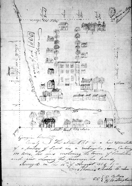
However, I did find what is possibly the cutest map (plat) ever. I was browsing through the "Georgia Cities" card index and found a random note saying a map of Lincoln County was located in drawer 119, box 10. Here's the map, complete with little trees and houses and a river. I look at this drawing and think that my Great-Great-Great Grandfather lived on a farm nearby and would have visited these streets.

2 comments:
Love it! I wonder how accurately drawn the houses were?
It's very sweet-looking, although I admit I never thought I would say that of a map! It almost looks like it should be a quilt.
Post a Comment